Geographic Analysis Software for Healthcare Follow-Up
Geographic Analysis Software for Healthcare Follow-Up
Authors: Giancarlo Paternoster, Dr. Umar Mian
Project Completed: November 2024
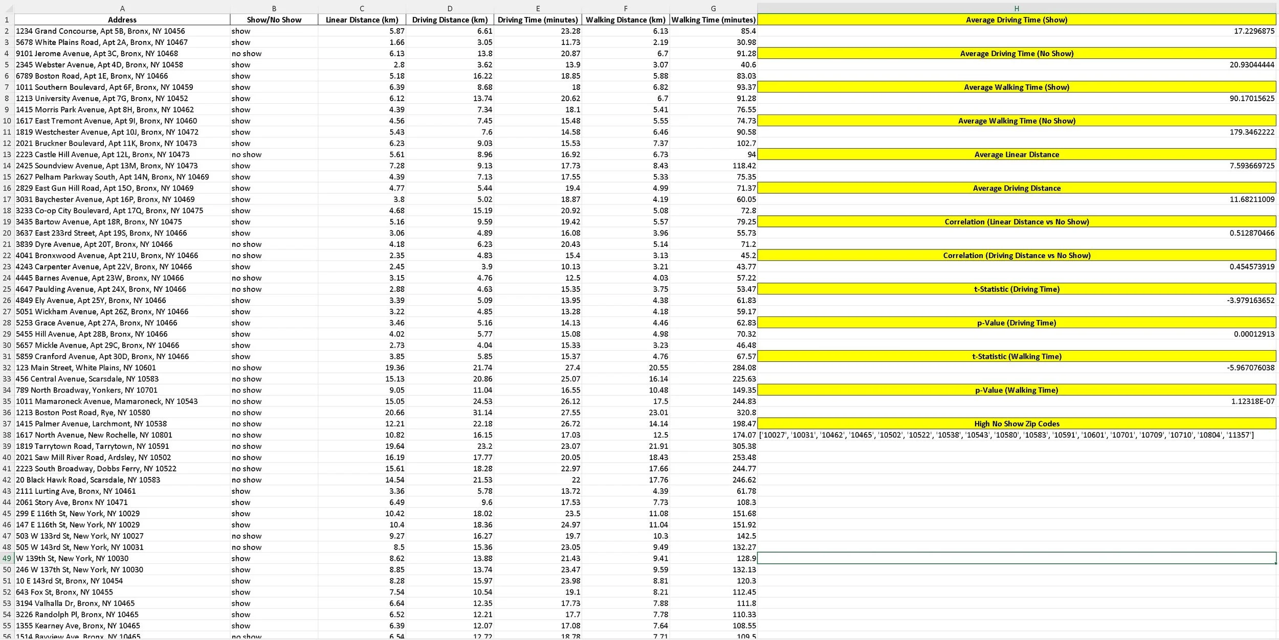
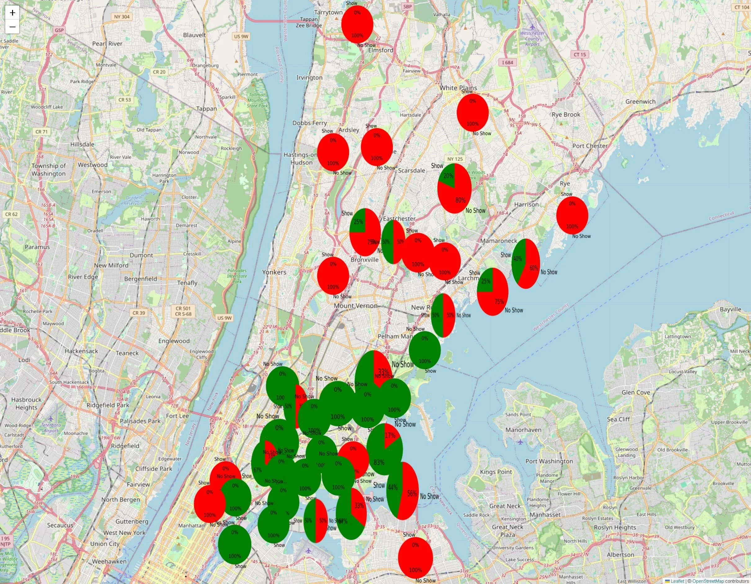
This project involves the development of a geographic analysis software tool designed to identify barriers to healthcare follow-up, particularly in underserved regions. Initially developed as a case study for Retinopathy of Prematurity (ROP) follow-up rates in Lahore, Pakistan, the software calculates linear distance, travel distance, and travel time from healthcare facilities. By mapping patient attendance data and analyzing no-show rates, the system provides healthcare providers with critical insights into geographic disparities in follow-up care. The tool allows for the identification of high-risk areas where patients are more likely to miss appointments, enabling targeted interventions such as mobile clinics or transportation assistance to improve accessibility.
Beyond its application in Lahore, the software has been adapted for use in urban healthcare systems, such as in the United States, where address uniformity and transportation data are more robust. By integrating geospatial analysis with patient follow-up data, the program can be used to optimize healthcare resource allocation, track adherence to post-hospital discharge care, and identify areas requiring public health interventions. The ability to visualize and quantify geographic barriers makes this tool a valuable asset in addressing healthcare disparities and improving patient outcomes in both low-resource and developed settings.